Category Archives: Glenn Wiebe

Historical TV, videos, and history teachers

16 mm projector

We’re all very aware of the stereotypical social studies teacher. Former jock. Current coach. Always busy with game plans and practice schedules. Hands out worksheet packets on Monday with a test on Friday. Constantly interspersed with movies and videos along the way.

We also know that the stereotype very seldom rings true. I was a coach for years. We all know great social studies teachers who teach and coach. I get the chance to wander the world working with all sorts of excellent social studies teachers. Keil Hileman in the Kansas City metro area district of De Soto uses 25,000 historical artifacts as part of instruction. He was the Kansas teacher of the year several years ago. Nathan Mcalister in Royal Valley MS simulates Civil War surgery with original medical tools, hosts a yearly history fair with kids hacking out canoes and building sod houses. His kids pushed an actual bill through both houses of the Kansas legislature. He was selected as the Gilder Lehrman national teacher of the year.

Kori Green routinely connects her students with kids around the world in live chats as they solve authentic problems. Jon Bauer teaches in one of the most isolated places in the state of Kansas while implementing all sorts of powerful learning activities. Activities such as having 8th graders rank historical events and developing a March Madness tournament as an end of year summative assessment. Jill Weber uses a variety of technologies to encourage high levels of learning including a TV Reality Show Pitch.

And yes. There are some teachers who perhaps could work a bit harder on their instructional design. I’ve seen those as well. But here’s the thing. Continue reading Historical TV, videos, and history teachers →

Summer reading list 2015

beach reading

It’s a Wiebe tradition.

The annual summer reading list.

For as long as I’ve been in education, I’ve had a summer reading list. Several of my early mentors suggested that the summer is a perfect time for personal professional learning.Develop a list of professional and fun books. Commit to reading them. Talk about the content with others. I eventually came around to the idea and learned to love it.

My wife, also an educator, started doing it. Later, we passed on the idea to our kids. The cool thing is that we’re all still committed to it. The best summer was the year my wife and I took a tech naked trip to the beach. Without the internet, there’s was nothing to do but sit in the sand and read. Awesome.

Of course, in all of the years that I’ve been doing it, I’ve never actually finished the original list. Schedules change. Books aren’t as good as I had hoped. It’s easy to get sidetracked. Work. Travel. Family stuff. But the idea is still a good one. It makes us better educators. And isn’t that part of the job?

So even though I’m pretty sure I won’t finish it, I still make the list. Cause one of these years, it’s gonna happen. All the books, all the way through. Really. I’m serious. This year for sure.

The 2015 Summer Reading List

Continue reading Summer reading list 2015 →

USGS historical topo maps

map explorer

Maps are so cool. Historical maps are way more cooler. And online historical maps are even way more cooler. (I like saying way more cooler cause it makes me feel like a rebel.)

A couple of months ago on the helpful GoogleMapsMania site, I ran across a way cool tool created by the United States Geological Survey. This is the group that, among other things, is responsible for creating topographic maps.

The cool tool that the USGS has created is called USGS Historical Topographic Map Explorer.

Basically, you do a map search with a Google Maps-like interface, click on a specific place on the resulting map, and the Historical Topographic Map Explorer will provide a timeline with topo maps from the past.

You can then select maps from Continue reading USGS historical topo maps →

Oodles of Constitution Day Resources

Franklin charms the ladies(Cross post from History Tech)

It’s that time of year again. Constitution Day 2014. September 17.

You know the story. A group of guys from different parts of the country with different ideas of how to govern got together and came up with a pretty amazing document. My favorite Founding Father?

Ben Franklin. He’s kind of like the sleeper pick in your fantasy football league – everyone knows he’s out there but they ignore him because all the focus is on Jefferson or Madison or one of the other first rounders. But you draft him anyway cause you know he’s got the skills.

Ben was smart, irreverent, great with people, well-read, the ladies loved him, he had that whole kite / electricity / scientist thing working, and was by far the best part of 1776 and John Adams. What’s not to love?

And so it’s fun to go back and read some of what Ben had to say about the document he was preparing to sign: Continue reading Oodles of Constitution Day Resources →

100 map and visuals that jump-start discussion

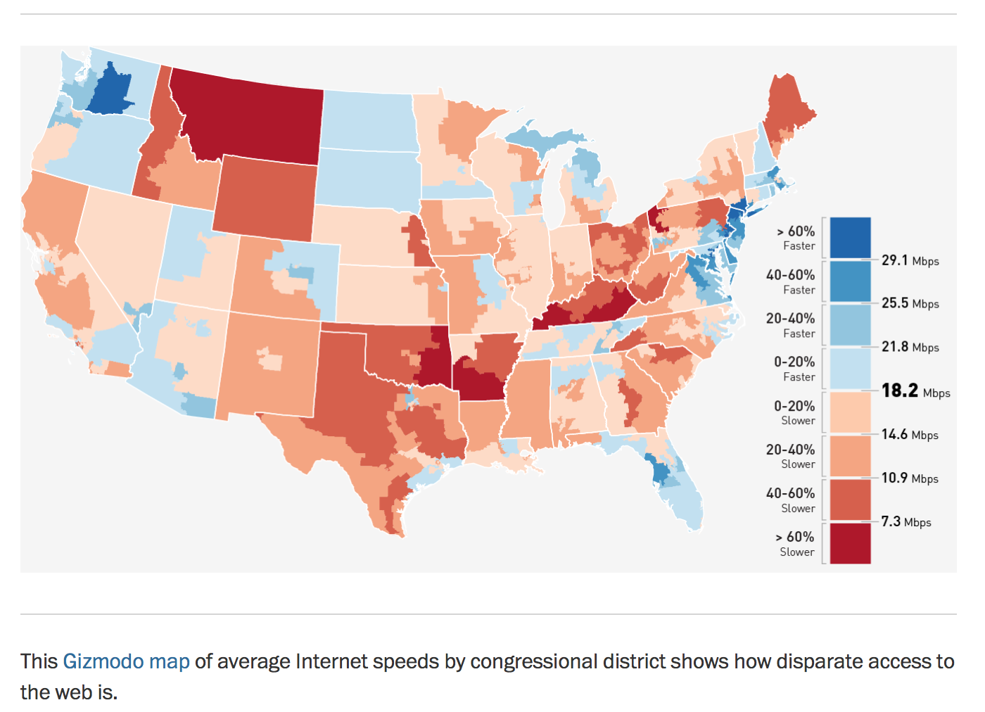
It’s no secret. I love maps. I’m pretty sure maps love me. Big. Small. Old. New. digital divide

Treasure.

I love ’em all.

And the cool thing about the InterWebs is that someone is always making new maps that I can fall in love with. Recently it’s been the Washington Post.

We’re all visual people and the brain loves to look at stuff. So all of the maps and charts listed below would work great as writing prompts, hook activities to introduce units and lessons, resources for research, basic geography skills, part of PBL projects, or to simply act as a sweet way to jump-start a current events discussion.

But I’m also sure that you’ll come up with all sorts of things that I haven’t thought about. (Don’t forget to use the links associated with each map to help your kids explore deeper.)

Here we go: Continue reading 100 map and visuals that jump-start discussion →