
 I love the Smithsonian magazine. Both the print and online versions. The articles are incredibly cool and range all over the place, from why we incorrectly believe that carrots help us see better to what people snacked on during the 1963 March on Washington.
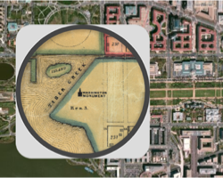
During a recent run through their online history articles, I ran across a very cool interactive activity that lets you look at past and present maps of six major US cities. The magazine recently dipped into David Rumsey‘s collection of over 150,000 maps to find some of the best representations of American cities over the past couple hundred years. With some simple programming, they were able to overlay images of vintage maps of some major cities onto satellite images from today. Continue reading Interactive maps compare current cities to 19th century versions


